Foehn Forecast Alps - Three Axis
When an air mass is forced over a mountain range, going from a high to a low pressure area, it cools adiabatically, that is without heat exchange with the rest of the atmosphere. On its way up, the atmosphere loses most of its humidity in the form of clouds and precipitation, a phenomenon called Stau. As it flows back down, it becomes Foehn, a warm, dry wind that flows on the low-pressure side of a Alps.
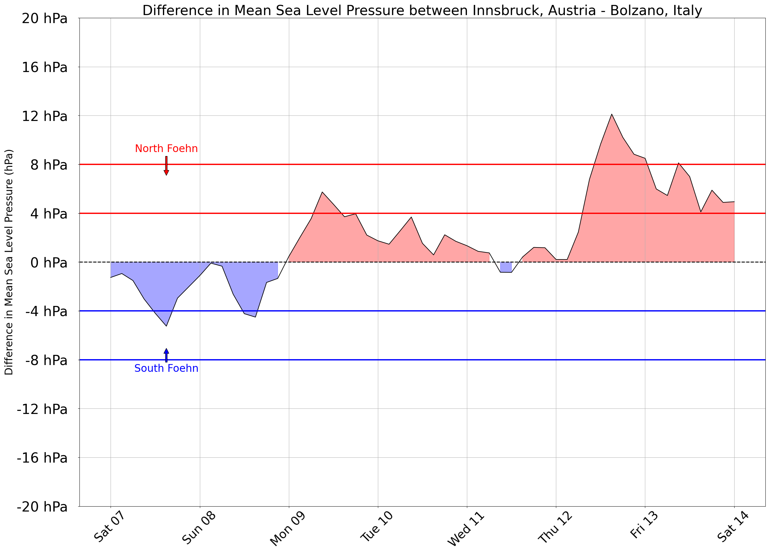
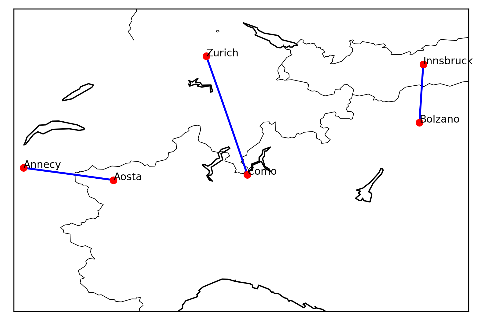
To forecast this phenomenon along the entire Alpine arc, we look at sea level pressure forecasts across three axes: Annecy-Aosta cutting through the Alps in the West, Zurich-Como in the Central region, and Innsbruck-Bolzano in the East.
Observations suggests that the pressure differential must be at least 4 hPa for the Foehn to affect Alpine valleys. When this differential exceeds 8 hPa, the Foehn often extends into the nearby lowlands, bringing blue skies and unseasonably warm temperatures to our cities. Learn more on Skybrary
Data source: NOAA GFS 0.25°
Updated daily at: 05:00 UTC
Suggestions? Email us at contact@atmosoar.io

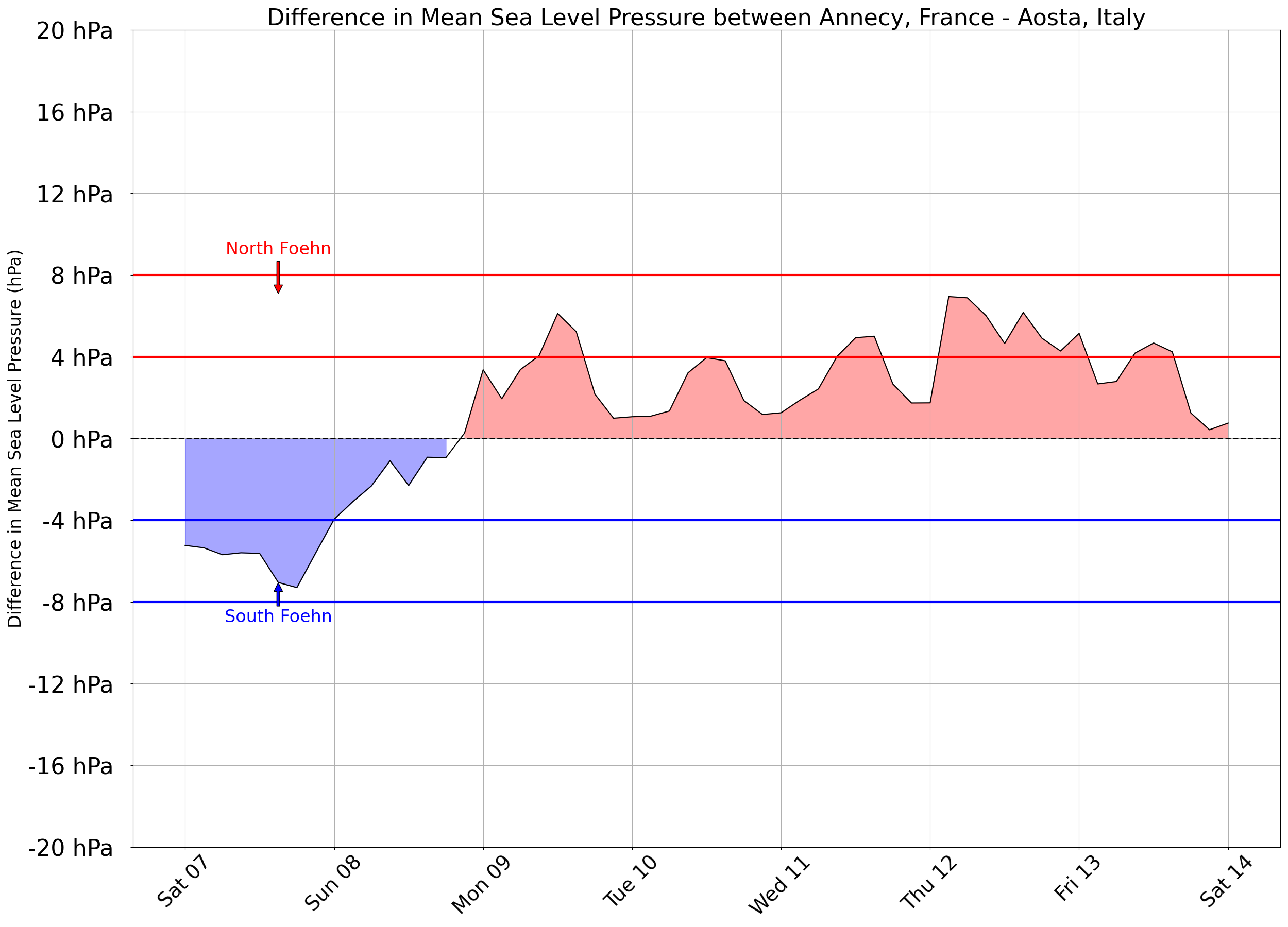
Annecy, France - Aosta, Italy
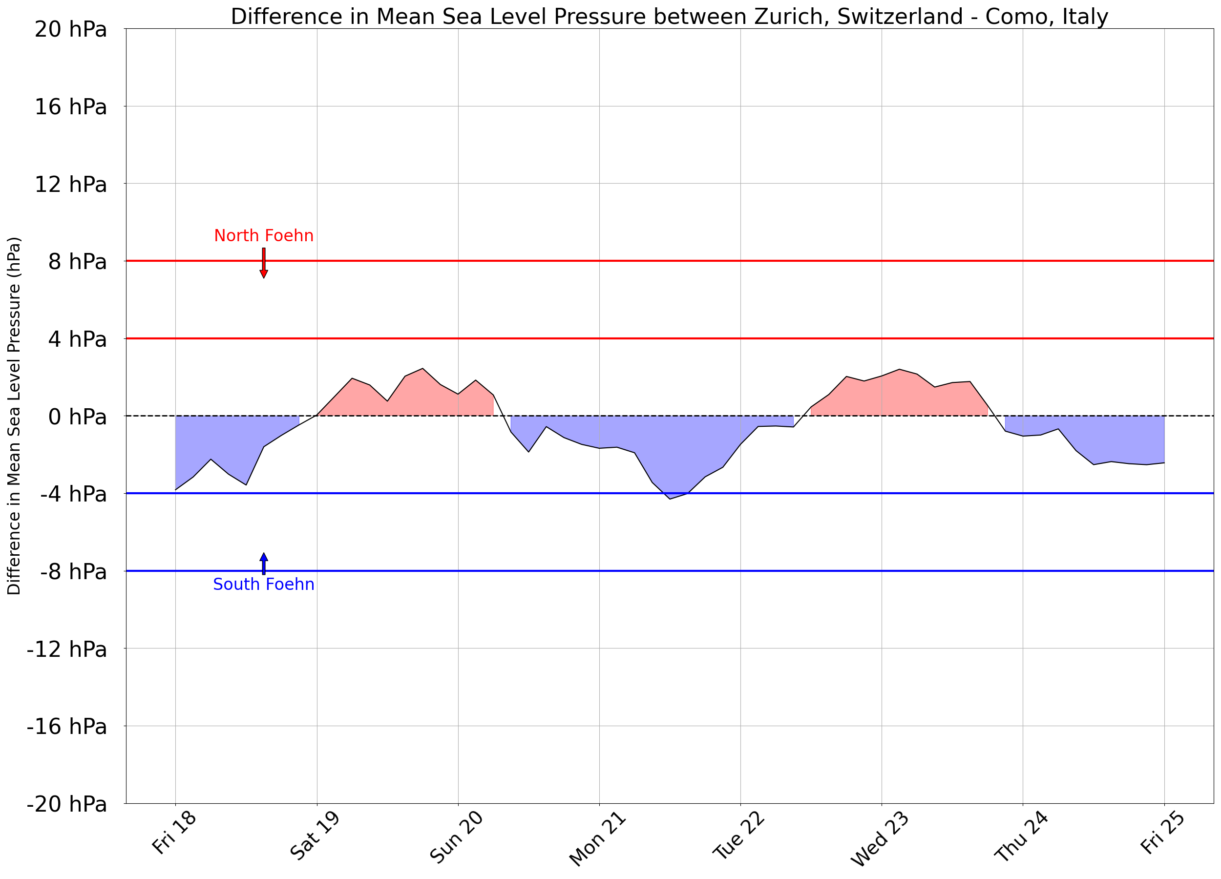
Zurich, Switzerland - Como, Italy